Welcome to the PerGeos Use Case Gallery
Below you will find a collection of use cases using PerGeos Software. Based on the technology of its predecessor Avizo Software, PerGeos is a robust software platform for visualizing, processing, and analyzing 2D and 3D digital rock image data.
These use cases include scientific publications, articles, papers, posters, presentations or even videos that show how PerGeos is used to address various scientific and industrial research topics.
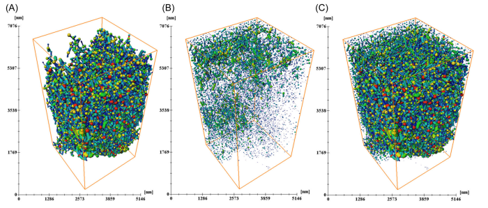
Knowledge of shale pore structure characteristics is crucial to understand gas
storage and seepage mechanisms. Organic matter (OM) pores are considered
the most important pore type in shale, and one of the currently significant
research questions focuses on the spatial distribution and connectivity of OM
pores. To answer this question, typical OM‐rich siliceous shale samples from
the Lower Silurian Longmaxi Formation were comprehensively investigated
usin... Read more
Hui D, Zhang Y, Hu Y, et al.
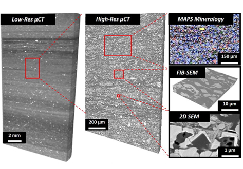
Optimization of production from shale reservoirs requires understanding of rock properties over a range of scales.
Multiple imaging techniques can be combined to determine the nature, connectivity, and wettability of nano-scale pore systems as well as the underlying mineralogy and organic textures that control reservoir behavior and the propensity of the matrix to fail and to contain expulsion cracks. The current study demonstrates new capabilities in integrated multiscale and time-res... Read more
Andrew Fogden, Alession Arena, Christopher Zhang, Ryan T. Armstrong
A Bridge With MAPS Mineralogy PerGeos v1.7
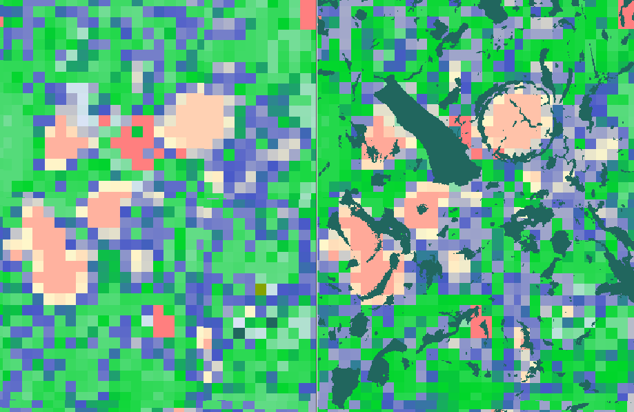
With the introduction of the Maps Mineralogy™ software suite, the successor of Qemscan, the technology has evolved, thanks to multiple patents bringing novel methods to acquire mineralogical information from digital rock samples with a modern and user friendly interface.
However, given the hardware technology advances and the emergence of new challenges in reservoir rocks, there is a need to fusion the mineralogical image and the back scattered electron... Read more
Gwenole Tallec - Thermo Fisher Scientific
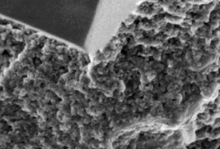
The complexity of unconventional rock systems is expressed both in the compositional variance of the microstructure and the extensive heterogeneity of the pore space. Visualizing and quantifying the microstructure of oil shale before and after pyrolysis permits a more accurate determination of petrophysical properties which are important in modeling hydrocarbon production potential. We characterize the microstructural heterogeneity of oil shale using X-ray micro-tomography (µCT), automated u... Read more
Imperial College London, Tarik Saif, Qingyang Lin, Alan R.Butcher, Branko Bijeljic, Martin J.Blunt